Travel by Any Means Necessary

Tag: history Page 6 of 8

Exploring the Chacchoben Ruins

While planning our cruise, I knew that I wanted to see some Mayan ruins. Through my research, I learned that that was an option at several ports. I examined the shore options in all the ports and decided the best option was to see the Chacchoben ruins in Costa Maya. This was a short port day for us; the all aboard time was 1:30, so I knew we didn’t want to risk this excursion through an outside company, especially because a lot of the shore excursion companies had the all aboard time as later in the day. Even though it was more expensive, we booked this one through Norwegian. As soon as the ship docked, we were off to meet our bus for our hour long drive to the ruins. This was one of the most popular excursions from Costa Maya and it was great to hear the history of the Mayans from our knowledgable guide, Alejandro.

Chacchoben is Mayan for place of the red corn. The Chacchoben ruins are a fairly recent archeological discovery. Discovered in 1972 when an American archeologist noticed some hills that didn’t fit in with the local landscape. Excavation began in the mid 90’s and the park opened to the public in 2002.

One thing our guide told us is that the Mayan people did not disappear as many people think. If you explore the area the Mayans are still around and the Mayan language can still be heard in the area around the ruins. It is believed that between 1000 AD and about the 1800s there was a draught that it made it impossible for the agrarian Mayan society to continue so the people dispersed and joined the other neighboring communities.

“I recently learned the phrase ‘correlation does not imply causation’. Every time I say ‘Monkey’, someone falls down”. – Alejandro, our tour guide at Chacchoben

Alejandro also explained the Mayan numeral system which made my head hurt. I think they should teach this in school instead of Common Core math. Future generations would have a much greater understanding of math if they could figure that out!

This visit really made me want to explore some more Mayan ruins. I am hoping to return to Mexico some time in the future to explore Chichen Itza or Tulum. Our guide in Belize explained that many of their Mayan ruins are still open for climbing, while many of the Mexican ruins are more protected. He also told us that the old Mayan buildings are some of the tallest buildings in Belize today, which is pretty unbelievable.

Anyway, if you cruise to Costa Maya, I highly recommend taking a tour of Chacchoben. It is great to get a taste of the history and the guides are incredibly knowledgable. Yes, there is a pool and a beach right at the port, it is good to get out an get a taste of Mexico’s history.

Thanks for stopping by! To read more about our cruise, click here. If you like my photos be sure to “like” my Facebook Page, follow me on Instagram, and Flickr! You can purchase prints on Etsy and Fine Art America. To see inside my camera bag, check out my Gear Page. For information about our new Guided Photography Tours, visit GuidedPhoto.com.

Pin This:


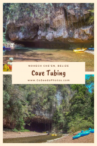
Cave Tubing in Belize

While planning our cruise, I was really torn with what to do with our stop in Belize City. All of the options were very outdoorsy or consisted of laying on the beach. I knew we were planning to relax the next day when we were at Harvest Caye, so I really wanted to get out there and explore the Belizean jungle. Cave tubing seemed like the perfect way to do that, so we booked it through ShoreExcursioneer.com to save a little money.

Belize City is a tender port, meaning there is no dock so to get ashore, people have to take smaller boats, called tenders, to take them from the ship to the cruise terminal. For whatever reason, it took a while to get the tenders started but we followed the directions on our ticket and took the first tender off the ship. Once we made it to land we went inside the shopping area, called the tourism village, to meet our tour. We were only the second group in line for our tour when we headed out to the buses.

After a little bit of drama with broken seats and another bus filling up and heading out, we made the hour long drive to the Nohech Che’en Archeological Preserve. During the drive our guide, Barry, told us a lot about the Belizean culture and the economy.

Once we made it, we got our life jackets and helmets and began a short walk through the jungle with many stops along the way to check out the local flora. I was excited to finally get in the water and begin our journey through the caves. Our other guide, Carlos, was handy with the flashlight, pointing out formations in the caves and telling us about the history. The water was moving very slow and frequently our guides had to get out of their tubes and pull us or swim to keep the group moving. It was kind of a strange experience, almost like being pulled by a human horse.

The ancient Mayans believed that the caves were the entrance to the underworld, called Xibalba or Place of Fright (MyBelizeExperience) and after floating through them, it is understandable why they thought that. It was a little eerie! I was glad I had my headlamp to see the cave formations and several bats.

After we got out of the water, they took us back to their office area where they had lunch of beans and rice, a Belizean specialty, waiting for us. Af this point, we were cutting it close to making it back to the port for the last tender. In the end, we made it back 15 minutes early. We didn’t have time to shop like some people were hoping, but I was just glad we didn’t miss the ship!

Overall, I am very glad we did this excursion. It was unlike anything else I’ve ever done! If you are cruising to Belize City, I highly recommend you check it out! To read more about our cruise, click here. Thanks for stopping by! If you like my photos be sure to “like” my Facebook Page, follow me on Instagram, and Flickr! You can purchase prints on Etsy and Fine Art America. To see inside my camera bag, check out my Gear Page. For information about our new Guided Photography Tours, visit GuidedPhoto.com.

Pin This:

Grand Canyon National Park: Desert View

View from the Watchtower at Desert View

I don’t know about you, but when I think of the desert, I think of snow. No? You don’t? Well, my first experience in the desert was 2 days of rain then driving north to discover several feet of snow. I was excited to experience dry heat on this trip and it felt exactly the same as the air feels in Michigan. For an area called Desert View, this, while still beautiful, was not the landscape I was expecting, even in February.

The Desert View Watchtower (below) is the man made landmark of this part of the park. Built in 1932 by architect Mary Elizabeth Jane Colter, it is meant to replicate towers in other southwestern cities. The tower was built to blend in with its surroundings. Colter herself described it as “One that would create no discordant note against the time-eroded walls of this promontory…The color and texture of this weathered surface rock naturally matched our terrain as none other could, but we were at the necessity of using it in just the shape it was found, as any tool mark became a conspicuous scar on the face of our walls. So we were obliged to select carefully for size and shape every unit of stone built into our masonry.” (NPS)

Climbing the watchtower affords great views of the canyon and the surrounding landscape. The interior of the tower on the first floor is decorated with paintings by a Hopi artist. Paintings on higher floors are replicas of those found in other southwestern sites. The paintings help get you in the mind set up the people who lived in the places many years ago. I imagine if you visit in the summer months, the watchtower gets very crowded, but it was relatively empty on this cold, snowy February day.

Thanks for stopping by! If you like my photos be sure to “like” my Facebook Page, follow me on Instagram, and Flickr! You can purchase prints on Etsy and Fine Art America. To see inside my camera bag, check out my Gear Page. For information about our new Guided Photography Tours, visit GuidedPhoto.com.

Pin this:

Kolb Studio

Kolb Studio at the trailhead of the Bright Angel Trail

The Historic Kolb Studio was built in 1905 and was originally a family home and photography studio of Ellsworth and Emery Kolb. The brothers were thrill seekers and were known to do crazy things to photograph of the Grand Canyon. They made their money photographing tourists riding mules down the canyon. They would develop the photos and the tourists would pick them up when they got back to the top of the canyon.

When the brothers first arrived at the Grand Canyon, they set up their first studio in a tent. Being that this is a desert and the closest water is 6,000 feet below, they had to get creative to find water to develop their photographs, like a muddy cow pond near the studio. Of course a dark room is essential to film photography and tent does not get dark enough to successfully develop film. So, they took over an abandoned mine shaft for that task.

The location of Kolb Studio was no coincidence. It is perched precariously at the top of the canyon, right at the trailhead of the Bright Angel Trail (the trail that goes to the bottom of the Grand Canyon). The brothers charged tourists $1 per mule that went down the trail, which was pretty expensive in those days, but was preferable to walking. The Kolb family operated the studio for over 75 years, until Emery’s death when the building was acquired by the National Park Service (grcahistory.org).

Now, the building is on the National Register of Historic Places. It currently serves as a gift shop and a museum to the Kolb brothers and Grand Canyon art. If you are looking to take home a qualitity photo of the canyon, stop by the Kolb Studio. They had the best photos we saw in any of the park stores.

Thanks for stopping by! Check back next week to hear more about our trip to the Grand Canyon! If you like my photos be sure to “like” my Facebook Page, follow me on Instagram, and Flickr! You can purchase prints on Etsy and Fine Art America. To see inside my camera bag, check out my Gear Page. For information about our new Guided Photography Tours, visit GuidedPhoto.com.

Pim This:

The House of Seven Gables

Salon in the Turner-Ingersoll Mansion with hand painted wallpaper

The Turner-Ingersoll Mansion, also known as The House of Seven Gables, is located in Salem, Massachusetts. It was built in 1668 by Captain John Turner and is the oldest timber frame house on its original foundation in the United States.  What is the significance of this old, New England home? It was the setting of Nathaniel Hawthorne’s 1851 novel, The House of Seven Gables.

Unlike The Wayside, Hawthorne never lived in this home, but he often visited his cousin, Susanna Ingersoll who regaled him with stories of the home. At the time that Hawthorne visited, four of the gables had been removed to match current architectural trends, but Ingersoll showed her cousin the beams and mortises in the attic illustrating where the additional gables used to be. If you’ve ever read the story, you know that the house is practically described as an additional living character.

A rare photo of me outside the Counting House at the House of Seven Gables.

In the early 1900s, the home was purchased by Caroline O. Emmerton who worked with an architect  to make the house reflect the one in Hawthorne’s story. Restorations included adding back the missing gables, creating a secret passageway in a chimney and adding a cent shop like the one run by Hepzibah Pyncheon in The House of Seven Gables.

Other historic Salem buildings have been moved to the grounds at the House of Seven Gables and can be toured with museum admission. Most noteably of these is Nathaniel Hawthorne’s birthplace.

If you are in Salem, I definitely recommend a stop at The House of Seven Gables. Unfortunately, due to the oppressive heat (it was 90 degrees at 10 AM), we didn’t get to see much more in Salem. After we left the museum, we headed north towards Acadia. Check back next week for our first look at Acadia National Park!

Thanks for stopping by! For more information about the House of Seven Gables visit 7gables.org. If you like my photos be sure to “like” my Facebook Page, follow me on Instagram, and Flickr! You can purchase prints on Etsy and Fine Art America. To see inside my camera bag, check out my Gear Page. For information about our new Guided Photography Tours, visit GuidedPhoto.com.

Boston Freedom Trail

Faneuil Hall – Boston

When planning our day in Boston, the one thing I knew I wanted to see was the Freedom Trail. Boston’s Freedom Trail is a two and a half mile route throughout the city marked with a red line that leads to 16 sites from the American Revolution. The trail begins at Faneuil Hall where we caught a free walking tour led by the National Park Service. Throughout the years, Faneuil Hall has had many purposes. The lower level is a marketplace. The second floor served as Boston’s Town  Meeting Hall (above) and the third floor held the town’s armory (NPS).

U.S.S. Constitution AKA Old Ironsides

Boston Common (bottom right), Old North Church, Old South Meeting House, Paul Revere’s House, the Site of the Boston Massacre, and the U.S.S. Constitute (left) are just a few of the sites along the Freedom Trail. The trail ends at the Bunker Hill Monument which commemorates one of the first battles of the American Revolution. Unfortunately it was closed during our visit due to extreme heat.

Soldiers & Sailors Monument in Boston Common

We were able to tour the U.S.S. Constitution. The U.S.S. Constitution is the oldest commissioned naval vessel still afloat and was named by George Washington. Interestingly, “Old Ironsides” is made entirely of wood. She was given the name during the War of 1812  when British cannonballs seemed to bounce right off of her. The ship’s copper fastenings were made by Paul Revere (Freedom Trail).

If you are planning on visiting Boston, I highly recommend the National Park Service Tours. For one it doesn’t cost anything and the tour guides are highly knowledgeable. Our guide wrote her Doctoral Dissertation on Paul Revere. I’m sure those other tours don’t have guides with that kind of expertise!

There is so much to see and do and Boston and one day is really not enough time to explore it all. Boston is definitely on my list of places to return with more time!

Thanks for stopping by! If you like my photos be sure to “like” my Facebook Page, follow me on Instagram, and Flickr! You can purchase prints on Etsy and Fine Art America. To see inside my camera bag, check out my Gear Page. For information about our new Guided Photography Tours, visit GuidedPhoto.com.

Pin This:
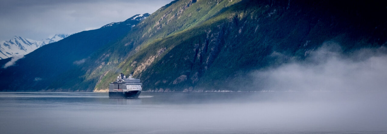
 

Wordless Wednesday: Old South Meeting House

Minute Man National Historic Park

Minute Man National Historic Park, located just outside of Boston, is home to many sites of significance of the first battle in the battle for American Independence. There are many sites of important historical significance located inside the park. The Battle Road Trail is a 5 mile trail that connects many of the sites within the park and would be a fun way to explore the park. Since this was our third stop of the day, we didn’t have much time to explore the park before it closed, so we drove between sites to maximize time.

The Old North Bridge, one of the sites in the park, is where the “shot hear round the world” was fired. The Minute Man statue (left) is located near the bridge and interestingly is made from seven cannons that were used in the American Civil War (wiki).  A monument at the site of Paul Revere’s Capture can be seen along the Battle Road Trail. Hartwell Tavern is another stop on the trail where costumed re-enactors talk about the home turned tavern and life in Massachusetts in the late 18th century.

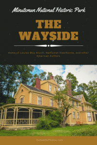
Pictured above is the Wayside, which is a home that has housed many famous American authors. Louisa May Alcott lived in the home as a child and it is said that her time at the Wayside inspired many scenes from Little Women. The Alcotts sold the home to Nathaniel Hawthorne (author of the Scarlet Letter and The House of Seven Gables among others) who named it The Wayside because it was so close to the road, he worried it would be mistaken for a coach stop. After Hawthorne’s death, the home was purchased by his son-in-law and author, George Parsons Lanthrop. Four years after that, Boston publisher Daniel Lothrop purchased the home with his wife, Harriet who wrote children’s books under the pen name, Margaret Sidney. In 1963 the home was named a National Landmark and joined Minute Man National park two years later (wiki).

The park is full of history and I recommend you take a trip to visit if you are in the Boston area. For more information, visit the National Park Service. If you like my photos be sure to “like” my Facebook Page, follow me on Instagram, and Flickr! You can purchase prints on Etsy and Fine Art America. To see inside my camera bag, check out my Gear Page. For information about our new Guided Photography Tours, visit GuidedPhoto.com.

Pin This:

Onieda Community Museum

The first stop on our recent East Coast Road Trip was at the Onieda Community Mansion Museum. This is an interesting place with a unique history. We had first heard about the Onieda Mansion on an episode of Planet Money. You know the Onieda silverware company, right? Did you know that they started out as a 19the century, perfectionist cult and free love commune? The mansion house (now a museum) was the home of the Onieda Community from 1848-1880. Led by John Humprey Noyes, the community “challenged social views on property ownership, gender roles, child-rearing practices, monogamous marriage, and work.” The community was way ahead of its time in the in the rights of women, in that the women of the community were able to participate in community work and they played an active role in shaping policy of the commune. (wiki and Onieda Community)

The mansion house itself is a beautiful building with unique details. There are many community spaces to explore including a beautiful library. There is also a large meeting space where the 300 members of the community would come together for religious purposes as well as community meetings. It is hard to imagine 300 people living together under one roof. Nowadays, the building houses a museum, gift shop, as well as apartments, and guest rooms. It was a very interesting place, but I will admit it had a kind of creepy vibe to it. The Onieda Community may have failed as a cult/commune/eugenics experiment, but they do make nice silverware.

While in Onieda, we also discovered the Wold’s Smallest Church. The Cross Island Church was built for a wedding so it can house a couple with a minister while the guests watch from boats on the water. I wish we had heard about this place earlier because we may have called ahead for a tour, instead we viewed it from the road. More information about this tiny church can be found at RoadSideAmerica.com.

Thanks for stopping by and reading what has to be one of the strangest posts on this blog! If you like my photos be sure to “like” my Facebook Page, follow me on Instagram, and Flickr! You can purchase prints on Etsy and Fine Art America. To see inside my camera bag, check out my Gear Page. For information about our new Guided Photography Tours, visit GuidedPhoto.com.

Pin This:


Wordless Wednesday: Wright Monument

Wright Monument

Page 6 of 8

Powered by WordPress & Theme by Anders Norén