Travel by Any Means Necessary

Category: National Parks & Places Page 10 of 12

Visiting Grand Canyon National Park

Our day at the Grand Canyon started early. I think we got to the Visitor’s Center around 8 o’clock, about an hour before they open. Because of that, we were one of the first cars in the parking lot and we were able to get some photos of the canyon while the lighting was still good.

If you’re not staying at one of the hotels in the park, there is not a lot of nearby lodging. We ended up at the Best Western Premier Hotel in Tusyan, which is right outside the boundaries of the park. Its one of two hotels you drive by to get to the South Rim. The hotel was rated highly online and the price was right so we booked it. Overall, I was very impressed with the hotel. The room was large and the bathroom was HUGE. It was a great surprise. Especially in an area where you will get people to stay at your hotel no matter what it looks like, I was impressed. If you are visiting the Grand Canyon, I highly recommend you check out the Best Western. The only way to get closer to the canyon is to stay in the park, which is pretty pricey and the rooms book up fast, even in the winter.

Besides a few hotels, there’s not much in Tusyan beside the National Park. There are a few fast food restaurants and there are some more formal restaurants located in the lodges in Grand Canyon Village, but nothing was very highly rated so we decided to skip it and just eat on the road. There is a grocery store in Grand Canyon Village where you can get the staples. It would be very handy if you were camping in the park or staying in one of the lodges that has a kitchen. You don’t have to worry about stocking up outside the park, although the prices in the park are more expensive than at a grocery store in Flagstaff.

Thanks for stopping by! For more information about the Best Western Premier, check out TripAdvisor. If you like my photos be sure to “like” my Facebook Page, follow me on Instagram, and Flickr! You can purchase prints on Etsy and Fine Art America. To see inside my camera bag, check out my Gear Page. For information about our new Guided Photography Tours, visit GuidedPhoto.com.

Pin This:

Grand Canyon National Park: Desert View

View from the Watchtower at Desert View

I don’t know about you, but when I think of the desert, I think of snow. No? You don’t? Well, my first experience in the desert was 2 days of rain then driving north to discover several feet of snow. I was excited to experience dry heat on this trip and it felt exactly the same as the air feels in Michigan. For an area called Desert View, this, while still beautiful, was not the landscape I was expecting, even in February.

The Desert View Watchtower (below) is the man made landmark of this part of the park. Built in 1932 by architect Mary Elizabeth Jane Colter, it is meant to replicate towers in other southwestern cities. The tower was built to blend in with its surroundings. Colter herself described it as “One that would create no discordant note against the time-eroded walls of this promontory…The color and texture of this weathered surface rock naturally matched our terrain as none other could, but we were at the necessity of using it in just the shape it was found, as any tool mark became a conspicuous scar on the face of our walls. So we were obliged to select carefully for size and shape every unit of stone built into our masonry.” (NPS)

Climbing the watchtower affords great views of the canyon and the surrounding landscape. The interior of the tower on the first floor is decorated with paintings by a Hopi artist. Paintings on higher floors are replicas of those found in other southwestern sites. The paintings help get you in the mind set up the people who lived in the places many years ago. I imagine if you visit in the summer months, the watchtower gets very crowded, but it was relatively empty on this cold, snowy February day.

Thanks for stopping by! If you like my photos be sure to “like” my Facebook Page, follow me on Instagram, and Flickr! You can purchase prints on Etsy and Fine Art America. To see inside my camera bag, check out my Gear Page. For information about our new Guided Photography Tours, visit GuidedPhoto.com.

Pin this:

Kolb Studio

Kolb Studio at the trailhead of the Bright Angel Trail

The Historic Kolb Studio was built in 1905 and was originally a family home and photography studio of Ellsworth and Emery Kolb. The brothers were thrill seekers and were known to do crazy things to photograph of the Grand Canyon. They made their money photographing tourists riding mules down the canyon. They would develop the photos and the tourists would pick them up when they got back to the top of the canyon.

When the brothers first arrived at the Grand Canyon, they set up their first studio in a tent. Being that this is a desert and the closest water is 6,000 feet below, they had to get creative to find water to develop their photographs, like a muddy cow pond near the studio. Of course a dark room is essential to film photography and tent does not get dark enough to successfully develop film. So, they took over an abandoned mine shaft for that task.

The location of Kolb Studio was no coincidence. It is perched precariously at the top of the canyon, right at the trailhead of the Bright Angel Trail (the trail that goes to the bottom of the Grand Canyon). The brothers charged tourists $1 per mule that went down the trail, which was pretty expensive in those days, but was preferable to walking. The Kolb family operated the studio for over 75 years, until Emery’s death when the building was acquired by the National Park Service (grcahistory.org).

Now, the building is on the National Register of Historic Places. It currently serves as a gift shop and a museum to the Kolb brothers and Grand Canyon art. If you are looking to take home a qualitity photo of the canyon, stop by the Kolb Studio. They had the best photos we saw in any of the park stores.

Thanks for stopping by! Check back next week to hear more about our trip to the Grand Canyon! If you like my photos be sure to “like” my Facebook Page, follow me on Instagram, and Flickr! You can purchase prints on Etsy and Fine Art America. To see inside my camera bag, check out my Gear Page. For information about our new Guided Photography Tours, visit GuidedPhoto.com.

Pim This:

100 Years of the Grand Canyon

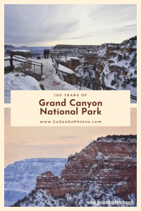
Today marks the 100th Anniversary of Grand Canyon National Park. Afraid that the Grand Canyon would turn into a tourist trap like Niagra Falls, Theodore Roosevelt declared it a National Monument in 1908, which protected the unusual landscape from development. It took 11 years for congress to get on board and designate The Grand Canyon as the 15th American National Park.

I recently got the chance to visit the Grand Canyon after a flush of strange Arizona weather. Where I was, in Phoenix saw two full days of cold rain. After north in the state saw copious amounts of snow. Roads were shut down. People were stuck at home. There was a message on the National Park Service page advising people to cancel their plans and come back another time. We were very close to doing just that, and if it wasn’t for the clerk at the rental car counter telling us that the roads should be fine, we probably would have. Luckily, by Saturday afternoon, the roads were clear so we headed north. The winter is the slowest time of the year at the Grand Canyon. After our experience this summer at Acadia, I was grateful for that. Because of the crazy weather and the travel advisories, I think traffic was even lighter than usual for a weekend in February. We left our hotel early Sunday morning and we were maybe the third car in the visitor center parking lot. It was cold, but definitely worth it.

The Grand Canyon is indescribable. You really have to see it for yourself to appreciate it. There’s a quote about the Grand Canyon that I love: “I have heard rumors of visitors who were disappointed. The same people will be disappointed at the Day of Judgment.” -J.B Priestly First view of the Grand Canyon Theodore Roosevelt described it best: “In the Grand Canyon, Arizona has a natural wonder which is in kind absolutely unparalleled throughout the rest of the world. I want to ask you to keep this great wonder of nature as it now is. I hope you will not have a building of any kind, not a summer cottage, a hotel or anything else, to mar the wonderful grandeur, the sublimity, the great loneliness and beauty of the canyon. Leave it as it is. You cannot improve on it. The ages have been at work on it, and man can only mar it.

Thanks for stopping by! If you like my photos be sure to “like” my Facebook Page, follow me on Instagram, and Flickr! You can purchase prints on Etsy and Fine Art America. To see inside my camera bag, check out my Gear Page. For information about our new Guided Photography Tours, visit GuidedPhoto.com.

Pin This:
Bass Harbor Head Light

You’ve seen the iconic photos of this lighthouse, right? Gorgeous sunset over the water and the lighthouse atop the rocks? They’re really something. I desperately wanted to get one of those pictures this trip!

As you can see from the above picture, I didn’t get the beautiful sunset I was dreaming of. First, I wasn’t prepared for how early the sun sets in eastern Maine. In Michigan, we’re lucky in that the sun stays up until 9:00 in the summer. In Maine, the sun sets more than an hour earlier. We were getting ready to make dinner and the sun was going down. It was like the opposite of camping at McLain State Park in the Keewenaw, where the sun didn’t set until almost 10. The other thing that made it difficult was the fog. Every evening we spent at Acadia was foggy or rainy. This is not a complaint, just a statement of fact. I was actually OK with it because it took the pressure off getting the perfect sunset photo.

Set the weather aside for a second. Because of the iconic nature of this lighthouse, everyone wants a photo of it. Photographers were lined up all over the rocks near the lighthouse. Here’s the kicker, they weren’t just taking a photo and heading on their merry way. Nope, they had their tripods set up and they were not budging until the sun was past the horizon. Chris is more daring than I and he weaved in between them to get this shot. It was not worth it to me. Honestly, I was disgusted with my fellow photographers over this. I could not believe the photographers looking out at the sea of other photographers, shrugging their shoulders and saying “well, I got here first”. Craziness. Especially because it wasn’t even that great of a sky that day.

So, you are going to be at Acadia and you want to try to get this shot. Here’s my advice for you.  Avoid summer. If you want to visit Acadia at all, avoid the busy season. The crowds are ridiculous. Late spring and early fall are supposed to be much better. And in fall you get the colors. I will have to make it to Acadia sometime in the fall. If you want the place to yourself, go in the winter. It never hurts to be the person staking out a spot. Try to get to the lighthouse early, just don’t be rude about it.

Thanks for stopping by! If you like my photos be sure to “like” my Facebook Page, follow me on Instagram, and Flickr! You can purchase prints on Etsy and Fine Art America. To see inside my camera bag, check out my Gear Page. For information about our new Guided Photography Tours, visit GuidedPhoto.com.

Pin This:

Hiking Jordan Pond

On our second day at Acadia National Park, we set out to hike the Jordan Pond Trail. Jordan Pond is one of the iconic features of the park and by taking the trail around it, you get into the woods and experience the real Acadia. As I mentioned in last week’s post, after two hot days in Maine, a storm rolled in and cooled it down to more comfortable, hiking weather.

The View from the Jordan Pond House

The trail begins near the Jordan Pond House Restaurant (left). The 4.3 mile trail is described as an easy, family, friendly hike. 2/3 of the trail are pressed dirt and boardwalks but the rough, rocky terrain near the back side of the pond surprised me. There were some spots where it was hard to get my footing and I was worried I was going to fall. If you want to enjoy the park and get away from the crowds, I recommend taking a hike. The parking lot was full, but it felt like we were the only people on the trail.

We were hoping to do some more hiking before we left Acadia but the weather did not cooperate. Chris really wanted to hike Bubble Rock (the mountain the can be seen straight back in both of the photos). Somehow, its described as an easy hike. How can climbing up a mountain be easy? Anyway, it stormed on our last day so we left early and began heading home. We will have to come back to Acadia another day and maybe I’ll be brave enough to conquer the Bubble.

Thanks for stopping by! Be sure to check back next week as we photograph Bass Harbor Head Lighthouse! If you like my photos be sure to “like” my Facebook Page, follow me on Instagram, and Flickr! You can purchase prints on Etsy and Fine Art America. To see inside my camera bag, check out my Gear Page. For information about our new Guided Photography Tours, visit GuidedPhoto.com.

Pin This:

Acadia National Park: Cadillac Mountain

Cadillac Mountain Panorama

Cadillac Mountain is the highest point on the east coast and is the first part of the country to see the sunrise each morning. At 1,530 feet tall, you can see most of Mount Desert Island from the top. As you can see from the photos on this page, fog is a common occurrence in the summer.

Cadillac Mountain is named for the French explorer, Antoine Laumet de La Mothe, Sieur de Cadillac who was given 100,00 acres of wilderness (including Mount Desert Island) in present day Maine from the French government in 1668. Of course, this is the same Cadillac who founded what is now the city of Detroit and is the namesake of Cadillac Motors. I love that little Acadia to Michigan connection. Before the name was changed to Cadillac in 1918, the peak was known as Green Mountain.

Oceana Insignia in Bar Harbor, as seen from Cadillac Mountain

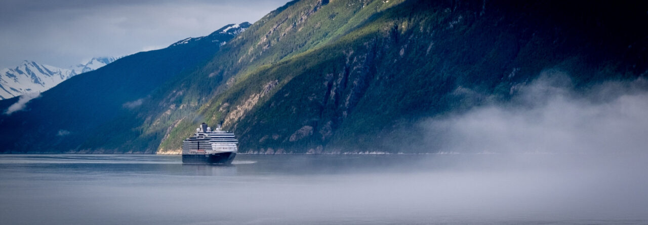
In recent years, Bar Habor has become a popular destination for cruise ships. I know a Canada/New England cruise is on my bucket list. A lot of people who cruise to Bar Harbor want to explore Acadia and of course, make a stop at Cadillac Mountain. The day we were exploring Cadillac Mountain, we could see a small ship off in the distance. The cruise nerd in me wanted to know which one it was, so I went onto CruiseTT, and discovered it was Oceana Insignia. It was funny walking around at the top of the mountain and seeing people who were dressed way too nicely to be exploring a National Park. I’m sure those were the cruisers.

If you visit Acadia, definitely make the drive up Cadillac Mountain. If you’re an early riser (and lets face it, I’m not) head up there at sunrise. The photos I’ve seen are breathtaking!

Thanks for stopping by! Be sure to stop back here next week when I will share about exploring Acadia by water! If you like my photos be sure to “like” my Facebook Page, follow me on Instagram, and Flickr! You can purchase prints on Etsy and Fine Art America. To see inside my camera bag, check out my Gear Page. For information about our new Guided Photography Tours, visit GuidedPhoto.com.

Acadia National Park: Park Loop Road

Thunder Hole at Acadia National Park

After we left Salem, we headed North to Maine. Upon first entering the state, I fell in love. There is something breathtaking and different about Coastal Maine. It looks like a mountain range, but smells like the beach. It was unlike anything I had ever experienced before. We arrived at Acadia and set up camp at Seawall Campground, which is located on the “quiet side” of the island. I didn’t really understand why they call it that until the next day.

Our first full day at Acadia was dedicated to driving the Park Loop Road. The Park Loop Road is the 27 mile road John D. Rockefeller Jr. built around Mount Desert Island so visitors can explore the park by automobile (instead of driving cars on the miles of the park’s carriage roads). We began our tour at the Hulls Cove Visitor Center. While at the visitor center, we picked up an audio tour of the park look road to listen to on our drive. I really enjoyed it because we learned some history of the park as well as some information about natural side of Acadia. Also at the visitor center, we got our first taste of Acadia’s summer crowds. Holy Cow. Before this trip, I read Moon’s Acadia National Park Travel Guide and it mentioned that July and August are the busiest times to visit Acadia. I went into it picturing the Sleeping Bear Dunes on Labor Day but it was more like Disney World around Christmas. Parking lots were packed. As you can see in the Thunder Hole picture above, people were just everywhere. Truly, trying to get a clear picture was like trying to get a picture of Cinderella’s Castle without the people in it. It just wasn’t going to happen. Between the crowds and the heat, I really struggled with photographic inspiration in one of the most beautiful places I have ever seen.

Schooner Head Overlook at Acadia National Park

The Moon book really pushed for visitors to use the free Island Explorer Buses (sponsored by L.L. Bean). They reduce emissions and help with the crowded parking lots. We decided for our first day in the park we would drive the Park Loop Road to give us the flexibility to stop and see anything we wanted to see. One of our first stops was the Schooner Head Overlook (left). Compared to the rest of the park and other sections of the Park Loop road, this was a very quiet spot. We only saw a few people on the trail, one of which was setting up an easel to paint. This would be a great place to watch a beautiful Acadia sunrise and to catch the first rays of sun in the United States.

Of course, we had to stop at Thunder Hole (above). It was very cool to hear the waves thundering into the natural rock inlet. It really does sound like thunder. We wanted to stop at Sand Beach and see the only sandy beach in the park, but we couldn’t find a parking spot, so we kept driving. If you are looking to visit Sand Beach, I highly recommend taking the Island Explorer because we visited around 9 the next morning and the parking lot was already full.

Crowds aside, I do recommend driving the Park Loop Road at least once because the Island Explorer bus doesn’t stop at every place you may want to see. In particular, the bus does not go to the top of Cadillac Mountain, so if you want to see the highest peak on the east coast (and if you’re in Acadia, you should) you can only get there by car or by climbing it. Personally, I don’t hike something if I can drive it and I definitely don’t hike up the side of a mountain, so we drove and that is the topic for next week! Be sure to come back to hear all about it!

If you like my photos be sure to “like” my Facebook Page, follow me on Instagram, and Flickr! You can purchase prints on Etsy and Fine Art America. To see inside my camera bag, check out my Gear Page. For information about our new Guided Photography Tours, visit GuidedPhoto.com.

Boston Freedom Trail

Faneuil Hall – Boston

When planning our day in Boston, the one thing I knew I wanted to see was the Freedom Trail. Boston’s Freedom Trail is a two and a half mile route throughout the city marked with a red line that leads to 16 sites from the American Revolution. The trail begins at Faneuil Hall where we caught a free walking tour led by the National Park Service. Throughout the years, Faneuil Hall has had many purposes. The lower level is a marketplace. The second floor served as Boston’s Town  Meeting Hall (above) and the third floor held the town’s armory (NPS).

U.S.S. Constitution AKA Old Ironsides

Boston Common (bottom right), Old North Church, Old South Meeting House, Paul Revere’s House, the Site of the Boston Massacre, and the U.S.S. Constitute (left) are just a few of the sites along the Freedom Trail. The trail ends at the Bunker Hill Monument which commemorates one of the first battles of the American Revolution. Unfortunately it was closed during our visit due to extreme heat.

Soldiers & Sailors Monument in Boston Common

We were able to tour the U.S.S. Constitution. The U.S.S. Constitution is the oldest commissioned naval vessel still afloat and was named by George Washington. Interestingly, “Old Ironsides” is made entirely of wood. She was given the name during the War of 1812  when British cannonballs seemed to bounce right off of her. The ship’s copper fastenings were made by Paul Revere (Freedom Trail).

If you are planning on visiting Boston, I highly recommend the National Park Service Tours. For one it doesn’t cost anything and the tour guides are highly knowledgeable. Our guide wrote her Doctoral Dissertation on Paul Revere. I’m sure those other tours don’t have guides with that kind of expertise!

There is so much to see and do and Boston and one day is really not enough time to explore it all. Boston is definitely on my list of places to return with more time!

Thanks for stopping by! If you like my photos be sure to “like” my Facebook Page, follow me on Instagram, and Flickr! You can purchase prints on Etsy and Fine Art America. To see inside my camera bag, check out my Gear Page. For information about our new Guided Photography Tours, visit GuidedPhoto.com.

Pin This:


Minute Man National Historic Park

Minute Man National Historic Park, located just outside of Boston, is home to many sites of significance of the first battle in the battle for American Independence. There are many sites of important historical significance located inside the park. The Battle Road Trail is a 5 mile trail that connects many of the sites within the park and would be a fun way to explore the park. Since this was our third stop of the day, we didn’t have much time to explore the park before it closed, so we drove between sites to maximize time.

The Old North Bridge, one of the sites in the park, is where the “shot hear round the world” was fired. The Minute Man statue (left) is located near the bridge and interestingly is made from seven cannons that were used in the American Civil War (wiki).  A monument at the site of Paul Revere’s Capture can be seen along the Battle Road Trail. Hartwell Tavern is another stop on the trail where costumed re-enactors talk about the home turned tavern and life in Massachusetts in the late 18th century.

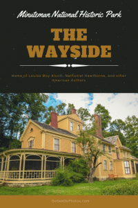
Pictured above is the Wayside, which is a home that has housed many famous American authors. Louisa May Alcott lived in the home as a child and it is said that her time at the Wayside inspired many scenes from Little Women. The Alcotts sold the home to Nathaniel Hawthorne (author of the Scarlet Letter and The House of Seven Gables among others) who named it The Wayside because it was so close to the road, he worried it would be mistaken for a coach stop. After Hawthorne’s death, the home was purchased by his son-in-law and author, George Parsons Lanthrop. Four years after that, Boston publisher Daniel Lothrop purchased the home with his wife, Harriet who wrote children’s books under the pen name, Margaret Sidney. In 1963 the home was named a National Landmark and joined Minute Man National park two years later (wiki).

The park is full of history and I recommend you take a trip to visit if you are in the Boston area. For more information, visit the National Park Service. If you like my photos be sure to “like” my Facebook Page, follow me on Instagram, and Flickr! You can purchase prints on Etsy and Fine Art America. To see inside my camera bag, check out my Gear Page. For information about our new Guided Photography Tours, visit GuidedPhoto.com.

Pin This:

Page 10 of 12

Powered by WordPress & Theme by Anders Norén