Travel by Any Means Necessary

Category: Hiking Page 4 of 5

Hiking Jordan Pond

On our second day at Acadia National Park, we set out to hike the Jordan Pond Trail. Jordan Pond is one of the iconic features of the park and by taking the trail around it, you get into the woods and experience the real Acadia. As I mentioned in last week’s post, after two hot days in Maine, a storm rolled in and cooled it down to more comfortable, hiking weather.

The View from the Jordan Pond House

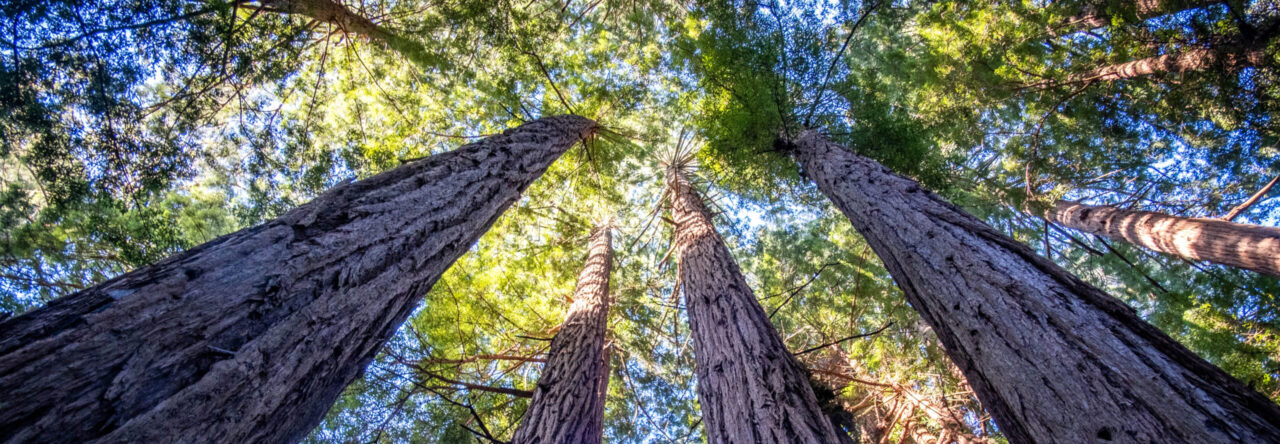
The trail begins near the Jordan Pond House Restaurant (left). The 4.3 mile trail is described as an easy, family, friendly hike. 2/3 of the trail are pressed dirt and boardwalks but the rough, rocky terrain near the back side of the pond surprised me. There were some spots where it was hard to get my footing and I was worried I was going to fall. If you want to enjoy the park and get away from the crowds, I recommend taking a hike. The parking lot was full, but it felt like we were the only people on the trail.

We were hoping to do some more hiking before we left Acadia but the weather did not cooperate. Chris really wanted to hike Bubble Rock (the mountain the can be seen straight back in both of the photos). Somehow, its described as an easy hike. How can climbing up a mountain be easy? Anyway, it stormed on our last day so we left early and began heading home. We will have to come back to Acadia another day and maybe I’ll be brave enough to conquer the Bubble.

Thanks for stopping by! Be sure to check back next week as we photograph Bass Harbor Head Lighthouse! If you like my photos be sure to “like” my Facebook Page, follow me on Instagram, and Flickr! You can purchase prints on Etsy and Fine Art America. To see inside my camera bag, check out my Gear Page. For information about our new Guided Photography Tours, visit GuidedPhoto.com.

Pin This:

Hiking Hocking Hills: Old Man’s Cave

 Old Man’s Cave is the most popular area of Hocking Hills State Park. It is the center of the park. The campground is here and of all the trails in the park, Old Man’s Cave had the most to see. Anticipating the crowds, I decided to visit Old Man’s Cave on Monday morning figuring that the weekend visitors would be gone and the crowds would be less. The rain that had been forecasted all weekend, finally came and I think that helped keep the crowds down too. If you were spending the whole week in Hocking Hills, you were not going hiking in the rain.

As you can see in the above photo, there were still people around and I was glad they were there. I used to be afraid of having people in my landscape photos. Now, I feel like the people in that photo add a frame of reference to the landscape. You can’t tell how big the cave is without people in it for perspective. The people also add life to the photos. They show that this is an area that people explore. They give meaning to the bridges and steps in the landscape.

Old Man’s Cave Upper Falls

While the rain kept the crowds down, it also really added to the atmosphere. Walking through the rainy, foggy, gorges felt like walking through another planet. It felt unreal. It reminded me of walking through Disney World, but this was not created by people. Really, words cannot describe this area. It has to be seen to be comprehended.

As I mentioned, the Old Man’s Cave Trail had the most to see of all the trails in Hocking Hills. There are five main sections of the Old Man’s Cave area, making up about one mile of trails: Upper Falls, Upper Gorge, Middle Falls, Lower Falls and Lower Gorge. Of course, one of the features of the trail is Old Man’s Cave (top) where a hermit lived in the late 1700s. The Grandma Gatewood Trail also begins here and continues on to Ash Cave and Cedar Falls.

Read more in my Hiking Hocking Hills Series: Camping & Hiking Hocking Hills, Ash Cave, Cedar Falls, Conkle’s Hollow and Rock House. To plan your trip to Hocking Hills, visit HockingHills.com If you like my photos be sure to “like” my Facebook Page, follow me on Instagram, and Flickr! You can purchase prints on Etsy and Fine Art America. To see inside my camera bag, check out my Gear Page. For information about our new Guided Photography Tours, visit GuidedPhoto.com.

Pin this!

Hiking Hocking Hills: Rock House

The hike to Rock House was the last hike of our full day in Hocking Hills and it was the hardest hike we did. Rock House is the only true cave in the park. It has a ceiling that is 25 feet tall and the main corridor is 200 feet long and is 30 feet wide in spots. Native Americans used the Hominy Holes as baking ovens. Troughs and holding tanks have been carved in the stone to collect rain water. Robbers, murderers and bootleggers once used this out of the way cave as a hideout. A hotel was once erected on the grounds on what is now the picnic shelter. (HockingHills.com)

The Rock House trail is only a half mile long but it is a half mile of large, uneven, sandstone steps. The trail is narrow and children and dogs should be closely supervised. The rock house at the end was totally worth the climb. It was unlike anything I had ever seen before. The giant rock house was significantly cooler and less humid than the surrounding areas and was nice break at the end of the climb. This would be a great place to visit around magic hour for better lighting for photos. The light was pretty harsh when we were there and made the spot difficult to photograph.

Read more in my Hiking Hocking Hills Series: Camping & Hiking Hocking Hills, Ash Cave, Cedar Falls, Conkle’s Hollow and Old Man’s Cave (coming soon). To plan your trip to Hocking Hills, visit HockingHills.com If you like my photos be sure to “like” my Facebook Page, follow me on Instagram, and Flickr! You can purchase prints on Etsy and Fine Art America. To see inside my camera bag, check out my Gear Page. For information about our new Guided Photography Tours, visit GuidedPhoto.com.

Pin this!

Hiking Hocking Hills: Conkle’s Hollow

The hike at Conkle’s Hollow was my favorite of all of the Hocking Hills trails we explored this visit. Conkle’s Hollow State Nature Preserve is not a park of the State Park but it borders the Hocking Hills State Forest and is less than a ten minute drive from Old Man’s Cave. Conkle’s Hollow was the quietest and least busy of all the sites in the Hocking Hills Region that we visited. I believe that being somewhat separate from the park has a lot to do with that. When we visited, we only saw a handful of other people on the trails. Or course, once we got to the waterfall, there were children playing in the water, like at the other waterfalls. If you are planning a trip to Hocking Hills, don’t discount Conkle’s Hollow because of the drive!

The gorge trail is ADA accessible and was one of the easiest hikes we did in Hocking Hills. The mile long trail follows the river through rugged cliffs, lush greenery, and wildflowers. The small waterfall at the end was stunning in that the sunlight seemed to cascade along with the water into the cave. Of course, if you are into more rugged hikes and have more time than I, the 1.9 mile rim trail offers gorgeous views from the cliffs above. The photos from up there are phenomenal! This would be a great hike to take in the fall.

Thank you for stopping by! Read more in my Hiking Hocking Hills Series: Camping & Hiking Hocking Hills, Ash Cave, Cedar Falls, Rock House and Old Man’s Cave (coming soon). For more information about Conkle’s Hollow, visit the Ohio Nature Preserves. If you like my photos be sure to “like” my Facebook Page, follow me on Instagram, and Flickr! You can purchase prints on Etsy and Fine Art America. To see inside my camera bag, check out my Gear Page. For information about our new Guided Photography Tours, visit GuidedPhoto.com.

Pin This!

Hiking Hocking Hills: Cedar Falls

When we arrived at the Cedar Falls parking lot, I heard so much screaming I thought there was a roller coaster at the end of the trail. Instead, at the end of the half mile trail we found the largest waterfall by volume in the park. You can see from the below photo, this is another popular spot in the park. The screams that could be heard from the parking lot were from visitors stepping into the chilly water and under the falls. Luckily, the water flowing from the falls wasn’t at full force when I visited, because stepping under the falling water can be dangerous.

Unlike Ash Cave, the Cedar Falls trail is not ADA accessible. It starts with a set of stairs known as Democracy Steps. These steps were designed by  artist, architect and mathematician, Akio Hizume, to be “pleasant and relaxing”. I have to say, of all the steps in the park, these were some of the easiest. Before looking at a map, I had forgotten stairs were involved in this hike. According to HockingHills.com “The lengths of individual steps are varied, so that walkers alternate the leading foot, establishing a comfortable pace and rhythm… It reflects mathematical principles of the Fibonacci sequence and the one-dimensional Penrose lattice.” Who knew math could make stairs more enjoyable?

Thank you for stopping by!  Read more in my Hiking Hocking Hills Series: Camping & Hiking Hocking Hills, Ash Cave, Conkle’s Hollow, Rock House and Old Man’s Cave (coming soon). To plan your trip to Hocking Hills, visit HockingHills.com. If you like my photos be sure to “like” my Facebook Page, follow me on Instagram, and Flickr! You can purchase prints on Etsy and Fine Art America. To see inside my camera bag, check out my Gear Page. For information about our new Guided Photography Tours, visit GuidedPhoto.com.

Pin This!

Hiking Hocking Hills: Ash Cave

Ash Cave

The Ash Cave Gorge Trail is probably the easiest hike at Hocking Hills State Park. The quarter mile, ADA accessible trail takes you almost all the way to the falls. The accessibility of this trail makes it a popular site as can be seen from the above photo. Of course, this spot wouldn’t be so popular if it wasn’t stunning. At 700 feet from end to end and the rim rising 90 feet from the ground, Ash Cave is the largest recessed cave in the state of Ohio. Of course, there are more challenging ways to explore Ash Cave as well. Climb 64 steps on the Rim Trail for get a view of the cave from above. (HockingHills.com)

It was forecast to rain the whole time we were in Hocking Hills. When we woke up on our first full day in the park and the rain hadn’t started, we quickly got ready and headed to the trails. Our plan was to see as much as we could before the rain

Ash Cavestarted and then head back to camp. I had learned since our time at Port Crescent last summer and I brought things to do in the tent to occupy us during the rain. Miraculously, it didn’t rain at all that day and we were able to explore everything we had hoped. What is my point? Don’t look at the weather forecast and cancel your plans! According to the meteorologists there was a 100% chance of rain that day and it didn’t actually start until after the sun went down. We could have cancelled the trip and stayed home but we would have missed these cool sites and some beautiful weather. Of course, that’s not always the case so you need to have a plan for rain. That can be tough tent camping, but some books, a pack of cards, and a rain coat should keep you occupied for a bit.

To plan your trip to Hocking Hills, visit HockingHills.com.  Read more in my Hiking Hocking Hills Series: Camping & Hiking Hocking HillsCedar Falls, Conkle’s Hollow, Rock House and Old Man’s Cave (coming soon). If you like my photos be sure to “like” my Facebook Page, follow me on Instagram, and Flickr! You can purchase prints on Etsy and Fine Art America. To see inside my camera bag, check out my Gear Page. For information about our new Guided Photography Tours, visit GuidedPhoto.com.

Pin it!

Camping and Hiking Hocking Hills

Cave Waterfall

Hocking Hills State Park is a geological gem in southeast Ohio. As someone who has spent a fair amount of time in Ohio over the years, this area does not feel like Ohio. It felt like a cross between the Pictured Rocks area in the Upper Peninsula and Natural Bridge in Kentucky. Paths and hiking trails weave through sandstone rock formations and around waterfalls to stunning, sometimes otherworldly, vistas. The park is full of towering sandstone cliffs, caves, and amazing waterfalls.

There is an experience at Hocking Hills for all abilities and interests from a leisurely stroll to a more rigorous hike. The trails to Ash Cave, Cedar Falls, and Conkle’s Hollow are easy, paved, and have rewarding views at the end. Old Man’s Cave (featured above) is a little more difficult with some beautiful bridges to cross and carved sandstone steps. We hiked Old Man’s Cave during a drizzle and it felt all encompassing and surreal. Rock House was the most challenging hike we did. It involved climbing narrow, boulder-like steps to an amazing cave-like rock formation that once was a hideaway for bandits. If you are even more adventurous, Cantwell Cliffs and The Hemlock Bridge Trail are more longer, more challenging trails with many steps leading to unique locations in the park. If you are looking to make a full day out of hiking, the Grandma Gatewood Trail connects a lot of the sites so you don’t even need a car to see them all.

During our time in Hocking Hills, we stayed in the Old Man’s Cave Family Campground Hike-in Sites. The hike-in sites are outside of the main campground at the mountain bike trailhead. The sites are fairly well spread out and most of them have a good deal of privacy. The four sites closest to the parking lot are first come first serve and the farthest site back is a good .8 mile walk from the parking lot with many sites in between. The path to the hike-in sites is gravel and a wagon is an easy way to transport your gear to your site. Even though the hike-in sites are separate from the main campground, hke-in campers are given main campground privileges such as use of the shower house and pool. I would definitely recommend the hike-in sites to tent campers that don’t require an electrical hookup because the sites at the main campground are very close together and lack privacy.

Read more in my Hiking Hocking Hills Series: Ash Cave, Cedar Falls, Conkle’s Hollow, Rock House and Old Man’s Cave (coming soon). For more information about the Hocking Hills Area visit HockingHills,com. Thanks for stopping by! If you like my photos be sure to “like” my Facebook Page, follow me on Instagram, and Flickr! You can purchase prints on Etsy and Fine Art America. To see inside my camera bag, check out my Gear Page. For information about our new Guided Photography Tours, visit GuidedPhoto.com.

Pin This!

Downpour at the Falls

Falls in the Rain

During my summer road trip series, I shared about our day of chasing waterfalls between Munising and Sault Ste. Marie. What I don’t think I mentioned was how, when we got to Tahquamenon Falls, clouds had rolled in. We climbed all the steps to the Upper Falls and it began to sprinkle. People started heading out in droves. We headed to the Lower Falls and that is when the clouds opened up. We’re not the type to be afraid of a little rain, but I was getting concerned about our gear, so we headed into the gift shop and hoped it would pass soon. Cell signal is not great up there, so I wasn’t able to view the radar. After hiding out for about 15 minutes it seemed to let off a little, so we staked out a spot by the falls and as quickly as we could, got a couple of shots then ran to the car to dry off.

About the Photo:
To be honest, this was such a quick, don’t let the rain ruin my gear, kind of shot that I didn’t put much thought to the settings. Because of the rain, the colors were very muted and not very interesting, so I converted it to black and white in Lightroom.

Camera Gear:
Nikon D3100 with 55-200 kit lens, leaned on the railing

Date Taken
June 30, 2016

Thanks for stopping by! If you like my photos be sure to “like” my Facebook Page, follow me on Instagram, and Flickr! To see inside my camera bag, check out my Gear Page. To plan your visit to Tahquamenon Falls (hopefully without the downpour), visit the Michigan DNR.

Kitch-iti-Kipi

Kitch-iti-Kipi
Kitch-iti-Kipi, AKA “The Big Spring” is the largest freshwater spring in Michigan. When I heard about this place, I had to add it to our road trip. Yes, it added a few extra hours to our longest driving day, but the view was unlike anything else I’ve seen. The only way to see the spring is by large raft that is maneuvered onto the spring by a wheel that propels the raft along a rope across the spring. An interesting fact about the spring is that the water is always 45 degrees so even in the dead of winter, it does not freeze. In fact, when it is cold, the fish congregate in the spring because it is warmer than surrounding waters.

About the Photo:
The spring was very difficult to photograph. It was a dreary, rainy day when we visited so the sky in my pictures was unusable. The above photo the best one I got and I actually took it on my phone and did a little Instagram editing.

Camera Gear:
iPhone 6

Date Taken:
June 27, 2016

Thanks for stopping by! If you like my photos be sure to “like” my Facebook Page, follow me on Instagram, and Flickr! To see inside my camera bag, check out my Gear Page. To plan your visit to the springs, visit the Michigan DNR.

Pin This!

Epic Michigan Road Trip: Rifle River

Rifle River Pano

Wow! We are at the end of my road trip! I am so sad to be done retelling it, but don’t worry, I have plenty more photos coming! Back to the trip!

After making our way down the Lake Huron coast, we headed inland to the Rifle River Recreation Area. We chose this as our last stop on the trip because it was literally the last campsite available in the northeastern part of the state for the Saturday before the Fourth of July. It was a rustic site, meaning no electricity and outhouses instead of bathrooms. The park was definitely the largest we visited on the trip. We drove for a while before we got to our campsite. And for the outdoor adventurer, there is a lot to do between hiking and canoeing, kayaking, and tubing. If you’re looking to camp and spend time on the water, this would be a great place for you!

About the Photo:
This shot was taken in the morning of the day we were heading home. Before we left the park I wanted to stop at the observation platform and get a photo for the blog. This shot was an 8 RAW exposure panorama stitched together with basic edits in lightroom.

Camera Gear:
Nikon D3100 with 18-55 mm kit lens, handheld

Date Taken:
July 3, 2016

Thanks for stopping by! If you like my photos be sure to “like” my Facebook Page, follow me on Instagram, and Flickr! To see inside my camera bag, check out my Gear Page. To learn more about Rifle River Recreation Area, visit the Michigan DNR.

Pin This!

Page 4 of 5

Powered by WordPress & Theme by Anders Norén